AN EARLY HOLIDAY SURPRISE!
DECEMBER 14, 2021
Christmas arrived early for this historian and it arrived in the form of a question. Can you identify the location captured in this photograph? Such inquiries make to my inbox from time to time but this one was especially exciting because it involved an interesting backstory attached to a great photograph.
The request came from a gentleman in California who attended graduate school at Rutgers in the 1970s. While there he had purchased a box of unidentified glass plate negatives at an antique shop. The collection had no provenance; just a box of discarded and forgotten images. As a photographer himself, he felt compelled to acquire the entire set. Slowly, over a period of years, he carefully digitized all the plates and began the laborious process of researching. During COVID, with time on his hands and with a need for a good project, he went on a deep-dive journey of discovery that led him to late nineteenth/early twentieth century New Brunswick, early photography and photographers, and eventually to 238 George Street; the home, he would come to learn, of the Howell family. And that’s where the story became especially interesting.
The Howell household included three unmarried sisters - Alice/Allie, Nettie and Margaret/Maggie. It seemed likely that one of these three sisters was the photographer behind the lens that captured their 19th-20th century lives in New Brunswick. A bit of digging revealed that two of the sisters died in the early twentieth century - Maggie in 1911 at 34 years old and Nellie in 1914 at 40 years old. Their deaths roughly coincided with the time frame of the collection of images which spanned from about the 1890s to the early 1900s which seems to suggest that either Maggie or Nellie was the unidentified photographer. The remaining sister, Alice, never married, continued to reside at 238 George Street with her brothers William and Charles and sister-in-law Anna, and passed away in the 1950s. The collection of glass plates were likely stored away in the house and forgotten. In time the home was sold and with no living descendants to claim this collection (another story) the box made its way to an antique shop in town and eventually into the hands of John Cruz. Not seen in many, many years, the collection revealed historic images of turn-of the century New Brunswick. Mr. Cruz went about the task of identifying locations, researching the family and learning about early photography and cameras. In an unselfish act of generosity, he donated this treasure of glass plates to the New Brunswick Public Library where they now safely reside. Thank you Mr. Cruz, you are a preservation hero!
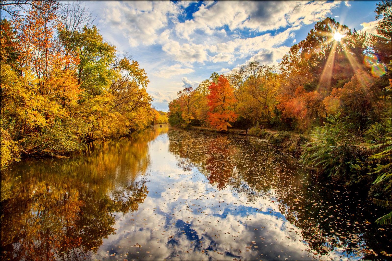
Included in the collection was a photograph that baffled him - the one seen on the bottom half of the comparison image here. He couldn’t place it. He thought it might be Landing Lane in New Brunswick since the majority of images were taken in and around the city but it didn’t quite match. He cast out a net in an effort to locate someone who might be able help identify the canal house captured by the Howell lens around the turn of the century. That inquiry eventually landed in my inbox. I was excited; it was without doubt a fantastic, newly uncovered, photograph of a D&R Canal bridge house but…which one? Without question, it was not Landing Lane! Although some features stumped me, my initial instinct was that this was the bridge house that once stood at what is now Route 518 in Rocky Hill. Two things stood out - the “Look Out For The Locomotive” sign (indicating the presence of a railroad connection) and the distinct curve of the approaching dirt road towards the bridge. It was the road that stood out and was so familiar to me. With a bit of digging I located an identified photograph from the collection of the Rocky Hill Community Group that captured that same distinctive curved road and the “Lookout for the Locomotive” sign - a match! The A-Frame swing bridge had been replaced by a Kingpost, but this was Rocky Hill.
And thus my early holiday surprise! A perfect gift for the historian in your life! So look in those attics, basements and stored away boxes…you never know what treasures from the past might be revealed or photographs of our canal are packed away. My inbox is always open! Happy Holidays everyone!
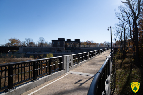
SCUDDER FALLS SHARED-USE PATH OPEN
NOVEMBER 16, 2021
We are so happy to share the news that the long-awaited shared-use path connecting New Jersey's D&R Canal State Park to Pennsylvania's Delaware Canal State Park at Scudder Falls is NOW OPEN!
The Delaware River Joint Toll Bridge Commission formally opened the crossing during a well-attended public ribbon-cutting ceremony. The ceremonial ribbon was cut by Anne Scudder Smith, ninth-generation descendant of early Ewing Township settler Richard Betts Scudder and the granddaughter of John Montgomery Scott who cut the opening-day ribbon on the first Scudder Falls Bridge in June 1961.
The new river link makes Scudder Falls the only river crossing allowing bicyclists to pedal across without dismounting their bikes.
John Cecil, the Director of the Division of Parks and Forestry, gave remarks at the opening ceremony on the importance of this new connection.
The New Jersey Department of Environmental Protection's Historic Preservation Office, Green Acres Program, and Division of Parks and Forestry were integral in the planning and coordination of this project with the New Jersey Department of Transportation and the Joint Toll Bridge Commission.
We are pleased to add this new loop trail crossing the Delaware River to the five others that link the D&R Canal State Park to the Delaware Canal State Park! Use it well and ENJOY!
Read more about it: COMMISSION OPENS NEW DELAWARE RIVER CROSSING FOR WALKERS, BICYCLISTS, SIGHTSEERS AT SCUDDER FALLS
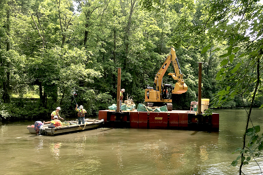
Dredge Project Updates for the 2020-21 Season
March 2021 Project update:
BE ADVISED:
Click here for details about this project.
December 2020 Project update:
BE ADVISED:
Click here for details about this project.
operations to begin in the spring:
BE ADVISED: The D&R Canal Dredging project will begin operations at Access Area 5 (East Millstone Park) located near the intersection of MARKET STREET and AMWELL ROAD starting on, or about, APRIL 1, 2020. The initial work involves mobilization of equipment and materials to the area, as well as a small soil sampling program. The contractor will occupy this area to support operations through October 31, 2020. Demobilization and restoration of the area will be conducted during November 2020.
PROJECT UPDATE: JUNE 12, 2020
VOLUNTEER EFFORT AT DUCK ISLAND A HUGE SUCCESS!
MARCH 1, 2021:
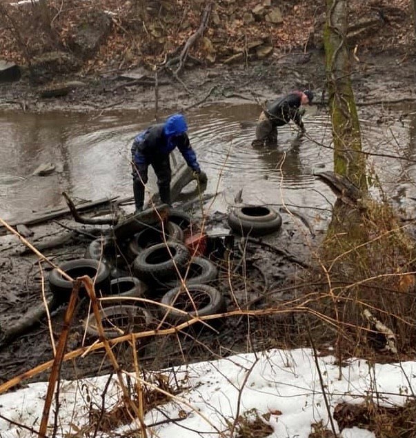
PARTNERSHIPS! This is how we can achieve our goals towards creating a healthier environment for all. On a rainy Saturday morning in late February, ten dedicated volunteers from the Central Jersey Stream Team, the Hackensack Riverkeeper, D&R Canal State Park staff and the owner of Tire Disposal Service pulled out 216 muck filled tires from the canal at the Duck Island section of the park - 216 TIRES!! While these dedicated volunteers provided the muscle power, the Mercer County Clean Communities program funded the responsible disposal of the tires. Some of the tires pulled our of the water date back to the 1960's!!! We can't thank all of these groups enough for taking on this challenge and look forward to PARTNERING with them again. There is more work to be done but with dedication of organizations like these we can make a difference. Please consider volunteering for a clean up near you, every set of hands is appreciated.
LAMBERTVILLE UPDATE: ASH & AILANTHUS TREE REMOVAL
ADVISORY - SEPTEMBER 4, 2020 (updated October 28, 2020):
Why do trees along the towpath have orange markers?
Project Work Dates: Nov 9, 2020 - Nov 20, 2020
Why are ailanthus trees being removed?
Why are ash trees being removed?
Why do these pests spread in D&R?
What is the timeline?
Tree removal and ailanthus stump treatment will begin in the Fall of 2020.
More information:
The park service has marked ailanthus and ash trees along the D&R Canal State Park towpath in the City of Lambertville (Eastern side of Canal) for removal.
Ailanthus altissima (tree of heaven), is an invasive non-native species which outcompetes New Jersey’s native species. It is also a species is known for attracting the invasive non-native insect the spotted lanternfly. The spotted lanternfly feeds on over 70 different plant species, including fruit trees, ornamental trees, vegetables, herbs and vines. The pest poses a threat to the health of New Jersey's agriculture and forests.
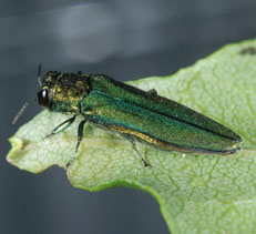
Ash trees have been impacted by the emerald ash borer, an invasive non-native beetle that has killed hundreds of millions of trees in North America. Once an ash tree is infested with emerald ash borer, the beetle kills the tree within three to four years, and 99% of the ash trees die after initial infestation. Ash die from the top down and rapidly become brittle, and potentially risk dropping large branches and tree tops. The brittleness of the infested trees poses a safety concern for park patrons in heavily-used areas. The removal of EAB-infested Ash trees throughout the park, including the City of Lambertville, has been specifically authorized by the Delaware and Raritan Canal Commission (DRCC #16-4938), which was granted a certificate of approval on February 15, 2017 which remains valid until 2022.
Delaware and Raritan Canal State Park is 70-miles long and wooded which helps the invasive insects easily spread throughout the park and to adjacent areas.