Boating
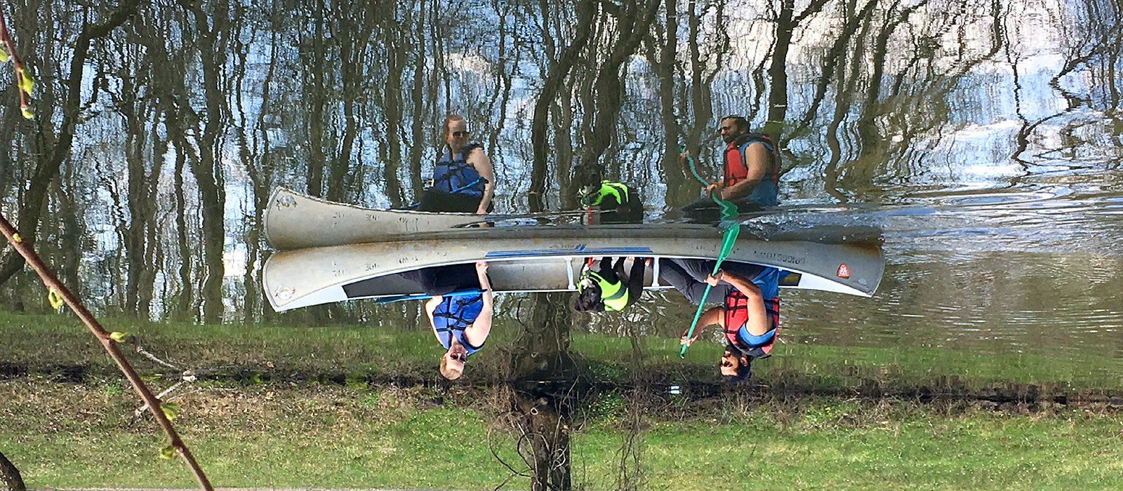
Both the Feeder Canal and the Main Canal offer miles of scenic, easy boating for canoes and kayaks. Water levels are fairly consistent, offering flat water boating with slow to moderate currents. Primary safety considerations are low bridges, and locks, which often must be portaged around, and often steep banks when entering or exiting one's boat. Properly fitted and closed life vests, aka PFDs, are recommend at all times.
Canoes, kayaks and small boats may be launched at several access points along the canal. Boaters must portage at the locks and at some bridges. Coast Guard approved personal flotation devices must be available for each boater. Only electric motors may be used on the canal.
Access to the Delaware River is available at five launching sites:
Also in Lambertville:
Boat Launches are available from sunrise to sunset year round.
For boats launched on the Delaware River, there are no motor restrictions, however, all New Jersey boating regulations apply.
There are restrictions on boating and canoeing in the canal. Only electric motors, car top launch, and canoes are permitted, which, can be rented from private concessionaires in Griggstown and Princeton.
Canoes can be rented at the following locations:
Delaware River Stream Gages and Stream Flow Information
The following is information on Delaware River flow and storage data, real-time stream gage data and high flood potential. This information is provided by the U.S. Geologic Survey and the National Office of the Atmospheric Administration (NOAA). Water levels for the Delaware River are regularly updated on their websites. Check the stream flow levels to assist you in making your decision.
Click here to monitor the current river water levels
This U.S. Geological Survey Water Watch site provides detailed information on the streamflow of waterways in New Jersey. Refer to the Reigelsville gaging station for water level information for the Delaware River along the D & R Canal State Park.
A map of New Jersey will appear. Proceed to the western edge of New Jersey to locate the RIEGELSVILLE dot. This dot is approximately 1/3rd of the way down the western side of the state.
Once the dot is “clicked” additional information will appear at the bottom of the page identifying “low” (red) “below normal” (orange), “normal” (green), “above average” (blue) and “high” (black) water conditions.
Click here for the U.S. Geological Survey Water Watch
The NOAA Advanced Hydrological Prediction Service for RIEGELSVILLE site provides a graph of the current and predicted water levels for the Delaware River in the vicinity of Frenchtown, Stockton and Lambertville, NJ. The real time water levels is sampled approximately every two hours.